The Cycling Network - Convenient?
Here are a couple of examples of why I find the provision of local cycle tracks to be inconvenient and unattractive to use.
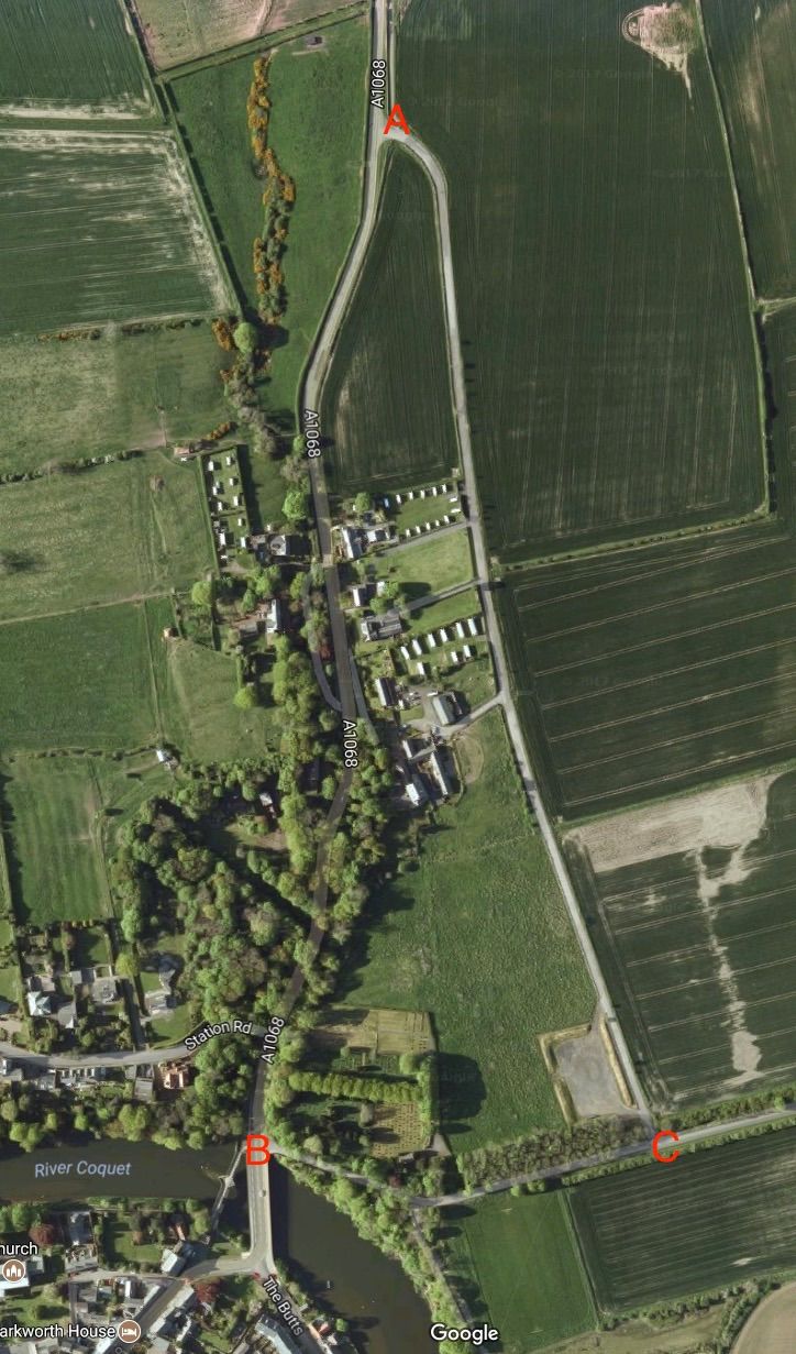
On the map below there are three marked points, A, B and C. The most direct route is a gently sloping road which has a good surface and this route runs from A to B. Section A to C is a potholed track which does not have a proper surface at all, section B to C is a very steep hill on a narrow lane.
Arriving by bike at either point B or point A the marked "cycle route" is shown to be along route B->C->A or A->C->B depending upon your direction of approach.
No doubt someone thinks this is "safer" - I think it's just directing cyclists along a far longer route, all of which is either very steep or completely unsurfaced and terribly potholed.
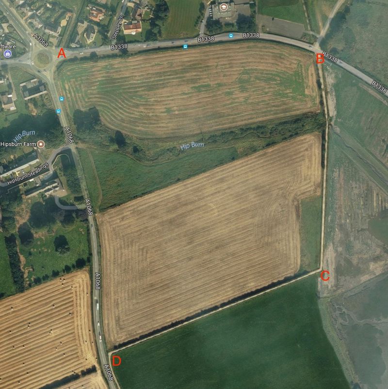
If I wish to use the cycle route between Hipsburn and Warkworth when cycling from Alnwick I will arrive at point A on this map. If I ride along the road from point A to point D I will almost certainly be abused by or hooted at by motorists who will normally yell something like "get off the ****ing road" or "use the ****ing cycle track".
The problem is that to join the cycle track I have to cycle from A to B, B to C and then C to D where it then follows the line of the A1068, there is no cycle track between A and D.
Am I being ungrateful in thinking that having to ride along three sides of a square, including going down a hill and then back up it, isn't a very attractive proposition?
comments powered by Disqus